🌄 Looking for a peaceful escape into the mountains?
Wangedigala is where adventure mixes with peace—perfect for hikers, campers, and nature lovers in Sri Lanka’s highlands. 🏔️✨ And yes, it’s an easy hike too! 👣
Discover the Beauty of Wangedigala
Looking for a peaceful escape into nature with a touch of adventure? Wangedigala is the perfect camping and hiking spot hidden in Sri Lanka’s central highlands. This hike offers stunning views, fresh mountain air, and a great camping experience for those who love the outdoors.
This trail is moderately difficult, taking about 3 to 4.5 hours to reach the top, depending on your fitness level. But once you’re up there, the beautiful sights and calm atmosphere make every step worth it.
🥾 A Popular Hike Among Students
This trail is a well-known hiking destination in Sri Lanka. It’s especially popular among university students because it’s an easy hike with no major difficulties.
⛺ Safe Camping Spots
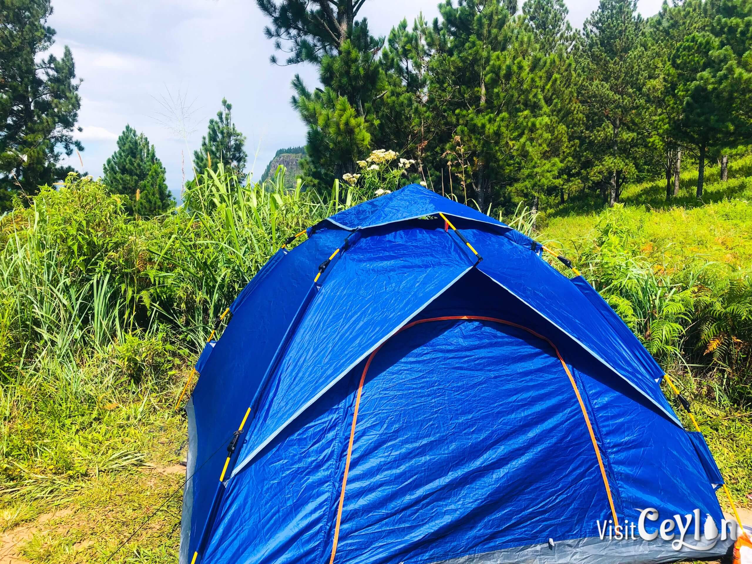
One of the best things about this hike is that there are several safe camping sites at the top of the mountain. So, if you’re planning an overnight stay, you’ll find plenty of spots to set up your tent and enjoy the cool breeze.
💧 Water Availability
Don’t worry about running out of water—there’s also water available at the top, which makes the hike even more convenient for campers and trekkers.
📖 A Little Twist in the Story
But before you pack your bags, I have to tell you a sad story about this place 😔. So stay with me until the end—you’ll want to know this before planning your hike.

Helpful Tips for Your Wangedigala Trip
💧 Bring Enough Water:
- Drinking water is a must when hiking Wangedigala. During the dry season, water sources at the top may completely dry up, so make sure to carry enough for your whole trip.
- In the mid-rainy season, however, you can usually find a natural water source even at the top of the mountain. Don’t worry—I’ll mark those natural water spots so you’ll know exactly where to refill. 🌿💦
🌧 Be Ready for Rain:
- The weather can change quickly. Carry a raincoat, a waterproof tent, and a gas stove.
- If you want to make a campfire, bring some dry firewood, especially if the campsite is crowded.
🥾 Shoes and Leech Protection:
- The first part of the hike is steep.
- In rainy seasons, there may be leeches. So, wear strong, covered shoes and long socks.
I did my hike during the normal season (not the dry season), and I didn’t find a single leech. I even managed to hike wearing just slippers! 👣
☀️ Check the Weather Before You Go:
- Knowing the weather helps you pack better.
- Don’t forget to bring a jacket—it gets cold at night!
Wangedigala live weather update 🛰️

- Temperature
- Precipitation
- Rain Chance
- Wind
- Humidity
- Pressure
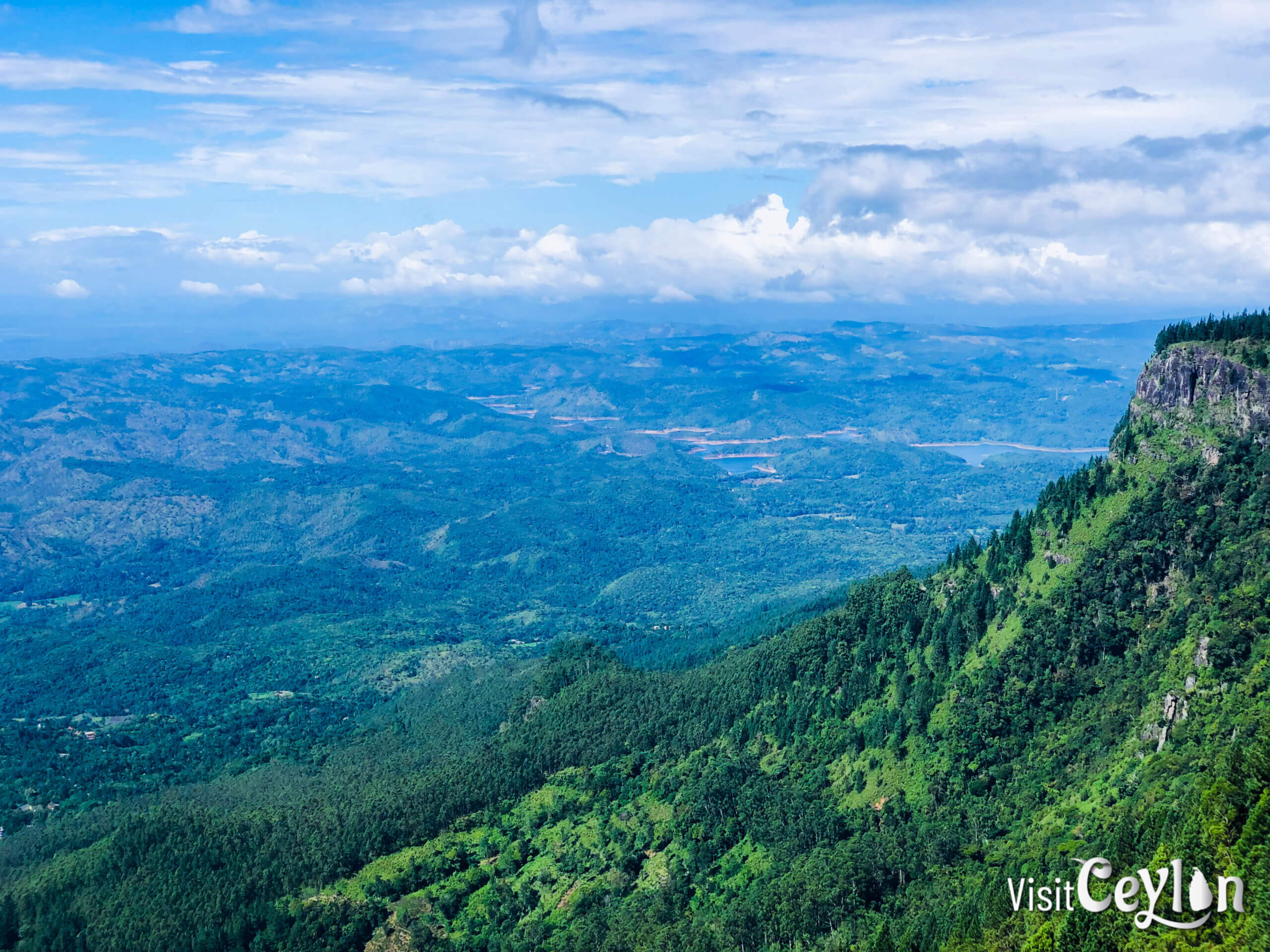
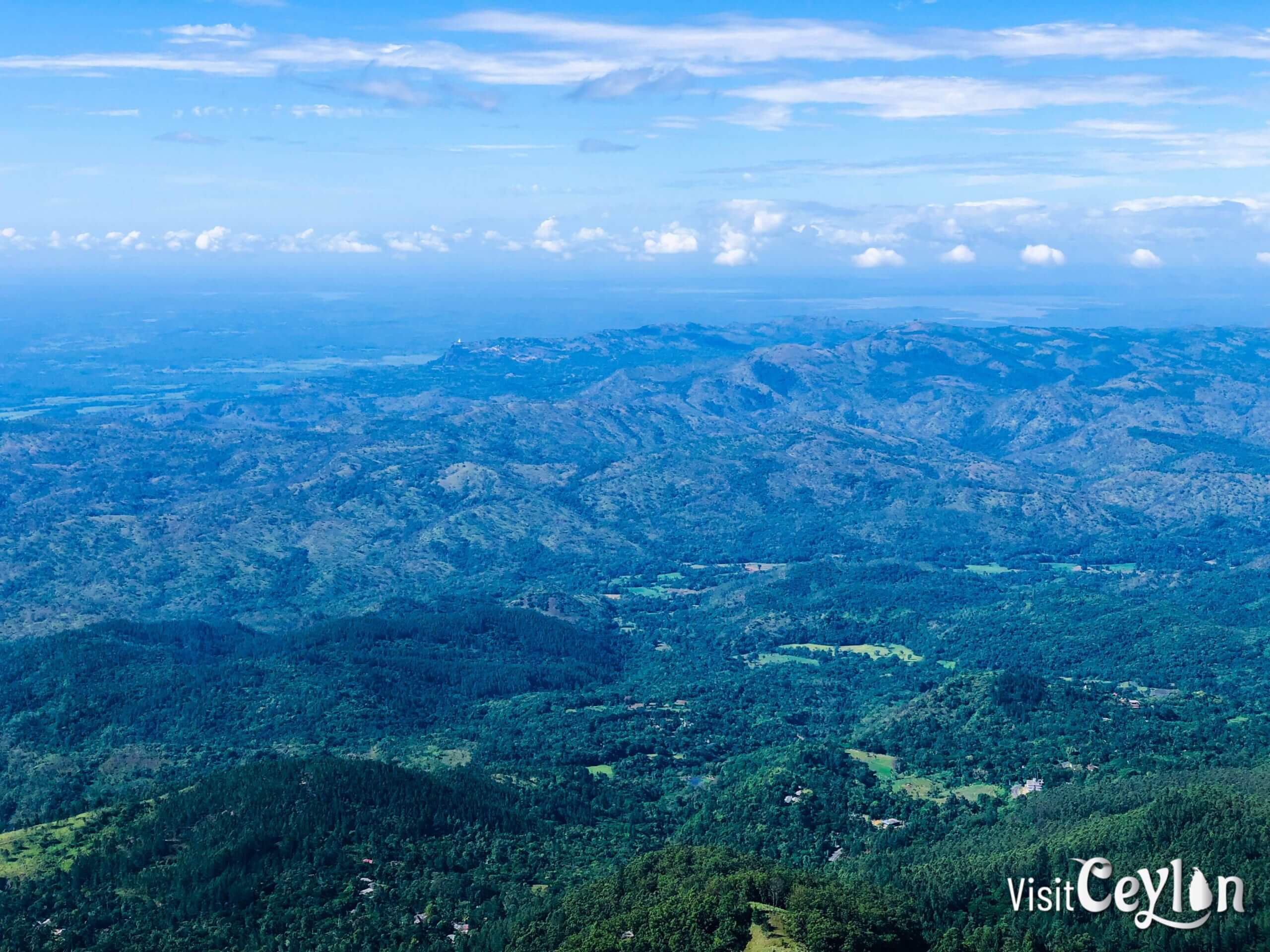
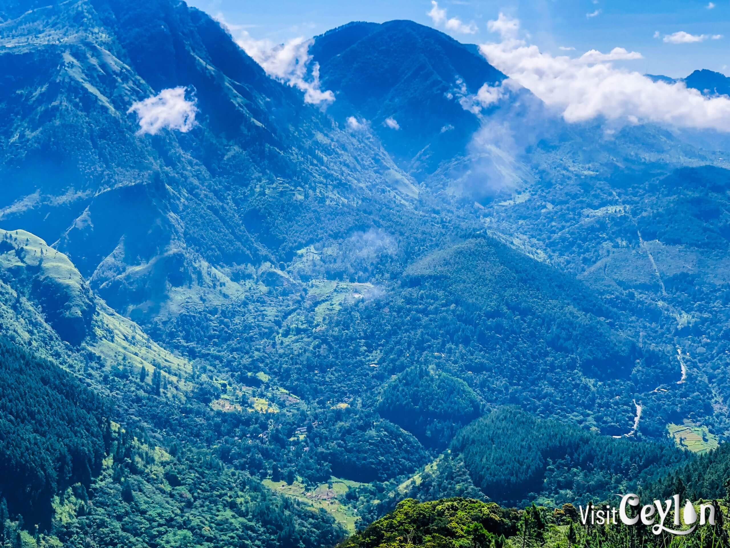
Amazing Views from the Top
At the summit, you’ll be greeted with wide views of the mountains and valleys. You can see:
- The famous World’s End cliff
- Bambarakanda Falls (Sri Lanka’s tallest waterfall)
- Weli Bend (Weli Wanguwa)
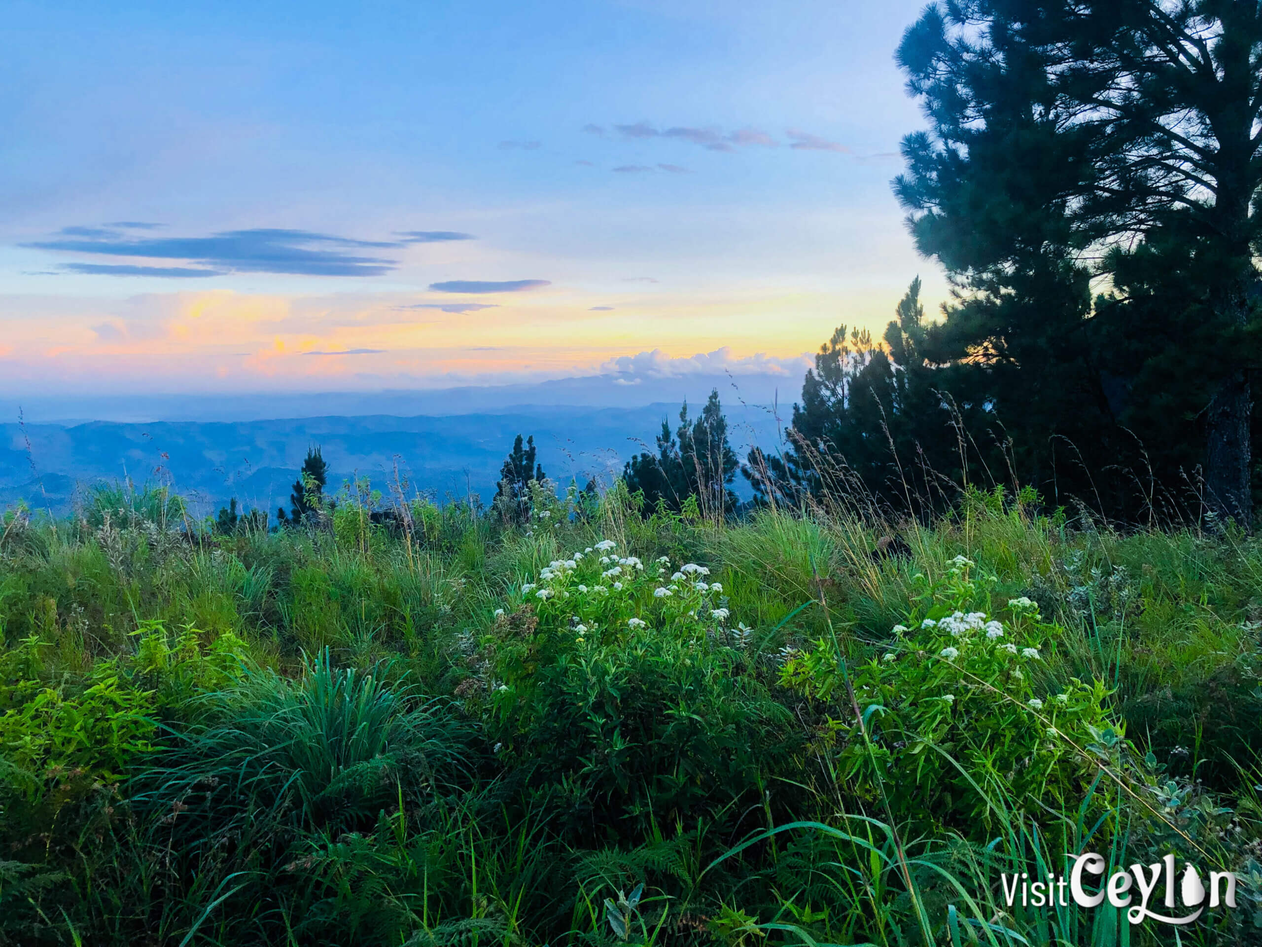
Camping at Wangedigala
- Nights can be chilly, so pack warm clothes.
- There’s plenty of space, even when multiple groups are camping.
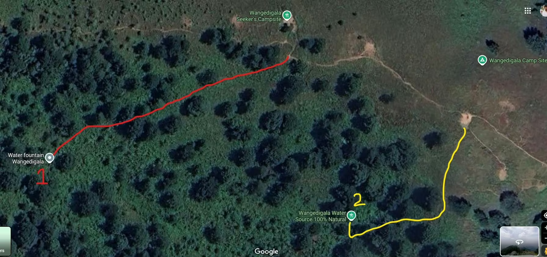
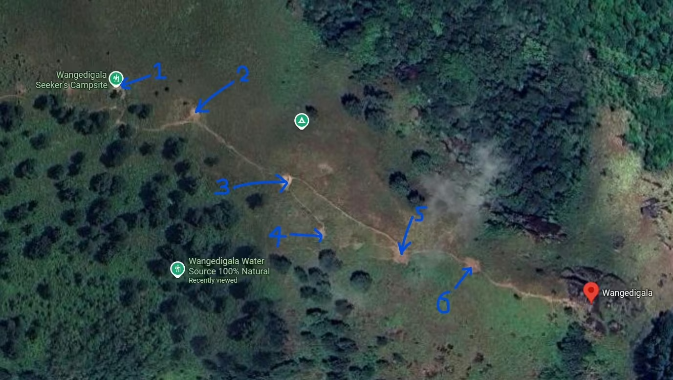
🏕️ Wangedigala Seeker’s Campsite (No. 1)
The most popular and most beautiful campsite at Wangedigala is the Seeker’s campsite. It sits right on the edge with a stunning viewpoint 🌄. It’s also close to the natural water spot trail, which I’ve marked as No. 1 on my map.
But here’s the thing—while it’s beautiful, it can also be dangerous. Strong winds are common at this spot, so make sure to be well-prepared if you camp there 🌬️.
🗺️ Other Campsites on Wangedigala
I’ve marked 6 campsites at the top of the mountain (though there are even more smaller ones around).
During my hike, campsite No. 1 was already taken by another group, so I camped at campsite No. 4. Honestly, it turned out to be a great choice—it was the closest to the water source, more private, and well-sheltered from the wind 🙌.
🌌 Campsite Vibes at Night
Most campsites on Wangedigala are visible to each other. At night, we even had a little fun by communicating with torch lights 🔦 between campsite No. 1 and ours. A simple, magical mountain moment.

Hiking Routes to Wangedigala
Choose a path that suits your level of fitness and adventure:
1: From Bambarakanda Falls
- Time: About 3.5 hours
- Highlights: Starts at the base of the beautiful Bambarakanda Falls. This is the most popular and direct trail.
2: From Kalupahana
- Time: 5–6 hours
- Highlights: Walk through peaceful countryside, villages, and maybe even spot wildlife.
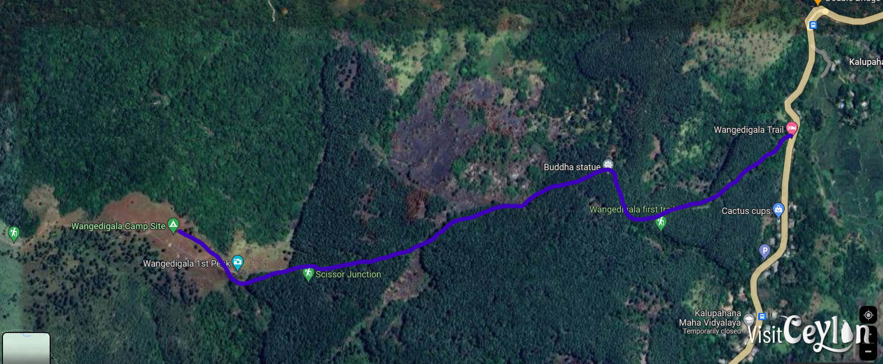
3: Wangedigala First Trail (from Weli Oya Bridge)
- Time: About 3 hours
- Highlights: A direct trail with pine forests and rocky paths. Great views and a fun hike for nature lovers.
🥾 Why I Chose the Wangedigala First Trail
I decided to take the Wangedigala First Trail from Weli Oya Bridge. At that time, I didn’t want to cover too many places in one hike, so this direct path felt perfect for me.
🚶 Stage 1: From Main Road to Dhammagiri Ashramaya
The first stage of the trail runs from the main road to Dhammagiri Ashramaya. When I hiked, the road was badly damaged—probably because of heavy rainwater. Even 4×4 vehicles couldn’t get through. I think that road was originally built for temple construction works.
So, I simply followed the road until I reached the entrance of Dhammagiri Ashramaya.
🌲 Stage 2: From Dhammagiri Ashramaya to Wangedigala
From there, the trail became less clear. The ground was covered with thick layers of old pine leaves, making the path hard to find. I relied on my mobile GPS to climb directly toward Wangedigala.
- 🌲 Pine cones were falling often—so watch out, you might get hit.
- ⚠️ The pine needles made the ground very slippery, especially with the elevation. Be careful—you could easily slip.
Luckily, after climbing for a while, I managed to find a proper trail leading to Wangedigala and followed it. The surroundings were simply beautiful.
💧 Water on the Way
During the hike, I found a clear water stream. I collected some water to drink and also washed my meals there, since I wasn’t sure if water would be available at the top.
👉 Note: In the dry season, you won’t find water sources at the summit of Wangedigala.
For your reference, I will put the Wangedigala First Trail (from Weli Oya Bridge) route GPS coordinates in GPX format.
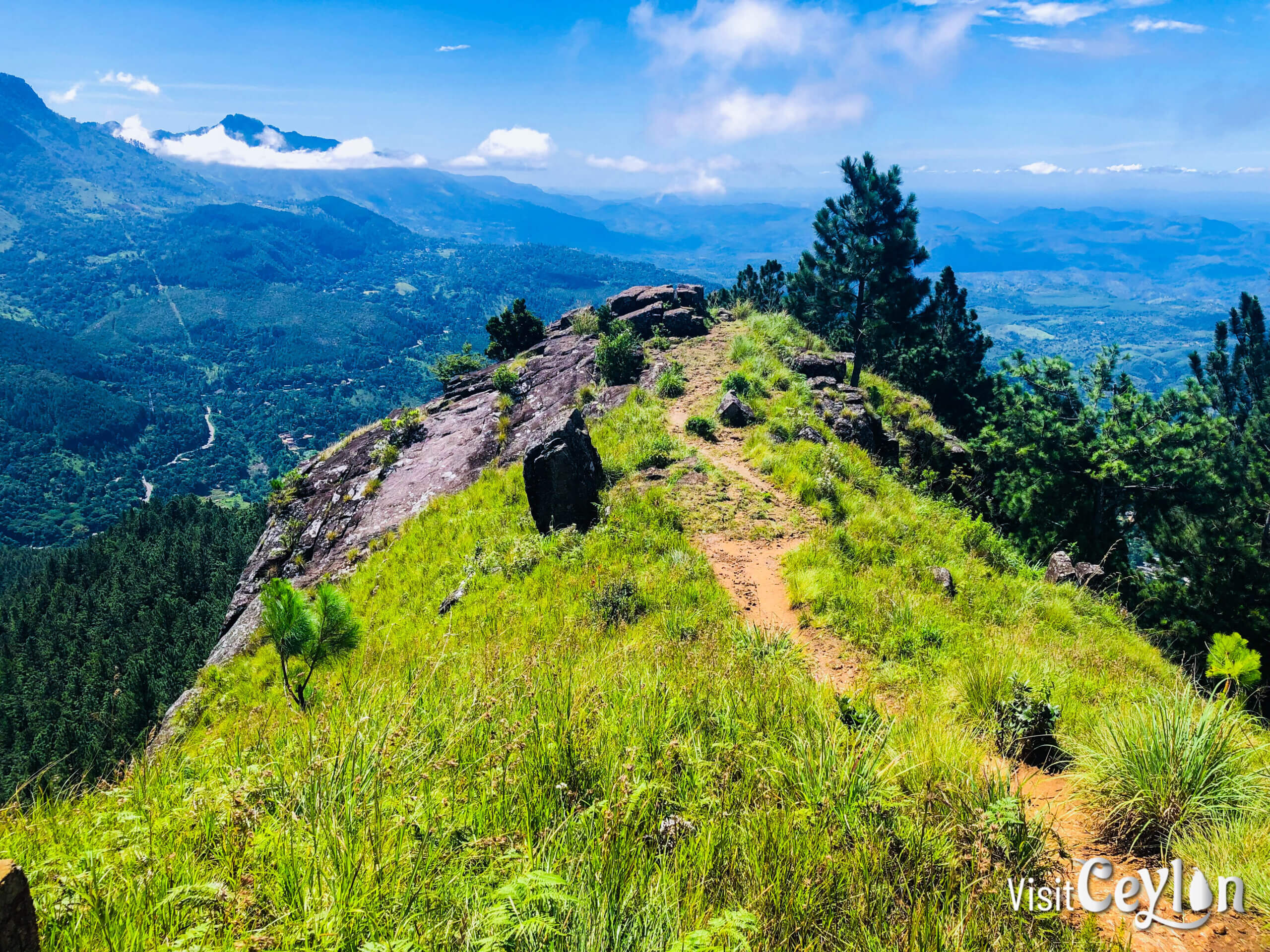
Don’t Miss Wangedigala Peak!
One spot you simply cannot skip is the Wangedigala Peak itself. 🌄
- It’s right along the trail, so easy to reach.
- The peak offers breathtaking views with cliffs and a wide-open surrounding.
- It’s also one of the best photo locations on the hike—perfect for capturing memories that will stay with you forever. 📸
👉 If you hike Wangedigala, make sure to stop here—you won’t regret it!
Go Beyond – Climb More Peaks!
If you love a good challenge, don’t stop at Wangedigala. Go for the full mountain adventure by reaching:
- Wangedigala Second Peak
- Balathuduwa Peak
- Gommoliya Peak
These climbs are tough, but the views and the sense of achievement are worth it!
🌅 Hike to the Second Peak
The next morning, I continued my adventure from the campsite and headed towards Wangedigala’s Second Peak—the destination I had in mind from the start.
The trail from Campsite No. 1 is quite clear, but you need to be careful of small rocks rolling downhill ⚠️. It takes about 30 minutes to reach the top.
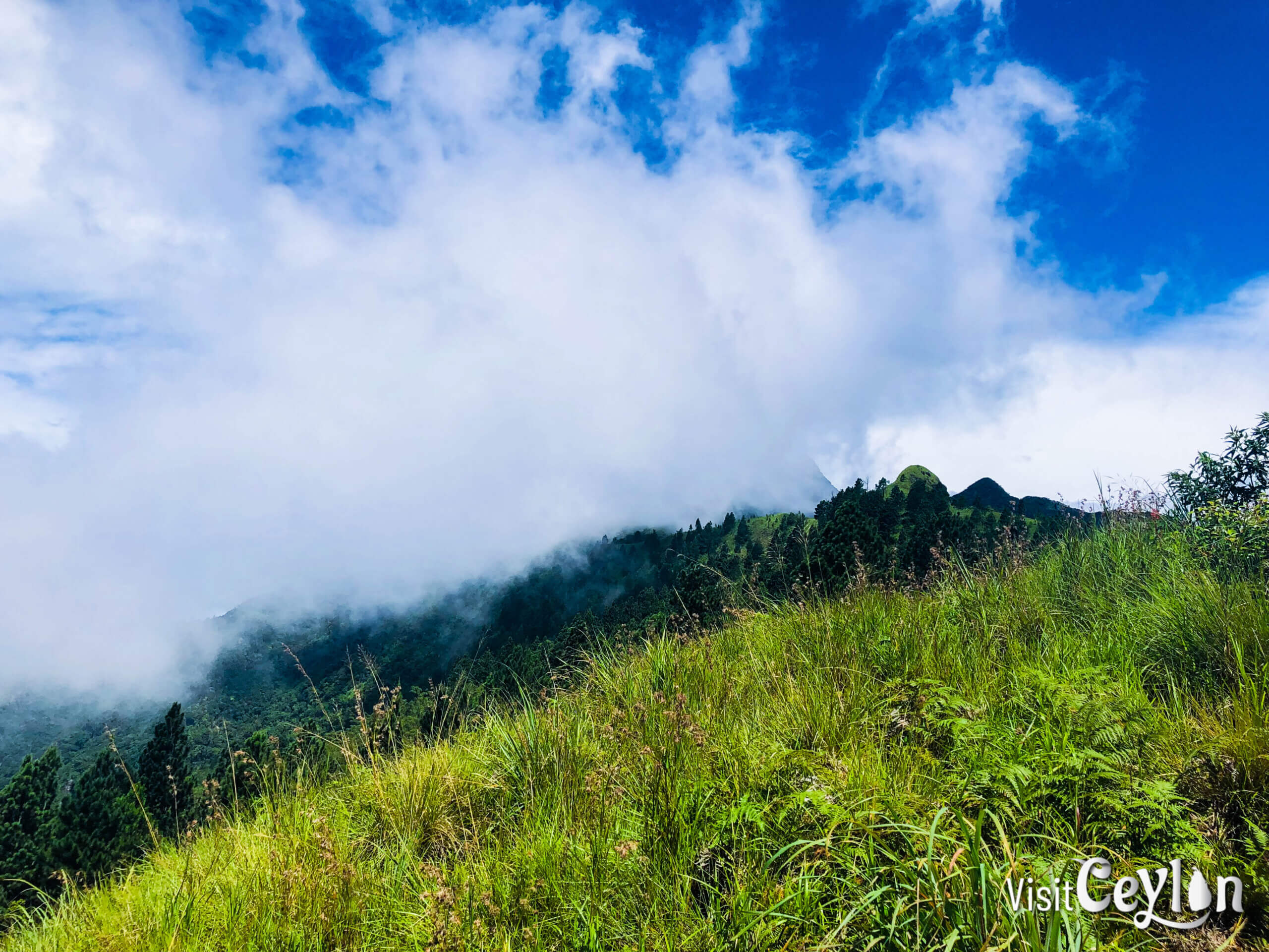
🌍 360° Views Above the Clouds
Once at the peak, you’ll be rewarded with breathtaking 360-degree views of the surrounding mountains. It’s one of those rare places where you can literally touch the clouds ☁️⛰️. The beauty from here is unforgettable!
⚠️ Safety First!
As magical as the Second Peak is, it’s also very dangerous:
- Strong winds 💨
- Steep slopes on both sides ⛔
- Narrow trails
So, enjoy the view—but stay alert and don’t take risks.
➡️ Beyond the Second Peak
The adventure doesn’t end there! If you’re up for more, you can continue along the trail towards Wangedikanda Peak and even further into the mountain range 🌲🏔️.
⚠️ Note: Wangedigala Hike is Restricted 🚫
Sadly, Wangedigala is now closed to the public. This decision was taken because many visitors kept throwing waste 🗑️ and damaging this beautiful place 🌿💔.
For now, permission is not given for visits. Let’s hope one day people will respect nature more, so such wonders can be opened again 🌍💚.
Many hikers still seem to visit, but I strongly do not recommend breaking the law 🚫.
If the Forest Department checks and finds you hiking during the restriction period, you can be fined Rs. 25,000 💸.
I’ve noticed that some people may hike here either ignoring the rules or simply because they don’t know about the restriction. But please—don’t risk it. Respect the rules, protect nature, and stay safe 🌿🙏.
🌄 Final Thoughts
Wangedigala was once a beautiful and popular hiking destination, but sadly it is now restricted to the public due to the mistakes of careless visitors.
Still, the message is clear: Wangedigala is a place of beauty—and it should stay that way. 🌱
If you ever choose to visit despite the restriction (which I don’t recommend), please:
- 🗑️ Take all your trash back with you
- 🌳 Respect nature as it is
- 🙏 Leave only footprints, take only memories
Nature is not just ours to use—it’s ours to protect. 💚
👉 Watch our video for a closer look at the journey and the campsite!
📌 Save this post and share it with your adventure-loving friends! 🏞️✨
Plan Your Adventure: Explore Our Interactive Map!
To make your journey even easier, check out our interactive map, where we’ve marked all these amazing destinations. Use it to plan your trip and discover more hidden gems in Sri Lanka!
To plan your trip with public transportation in Sri Lanka, visit Sri Lanka Railways for train schedules.
📸 Lots of Photos from My Journey!
I’ve captured many beautiful and unforgettable moments during this trip. 🌿🏞️✨
👉 You can check out all my photos on my Facebook profile here:
🔗 My Facebook Photo Albums
💚 If you enjoyed them, don’t forget to follow me for more travel stories, adventures, and hidden gems from Sri Lanka! 🌍✈️📷